EASI Eastern Alpine Seismic Investigation

(© IMGW)

(© IMGW)
EASI Eastern Alpine Seismic Investigation
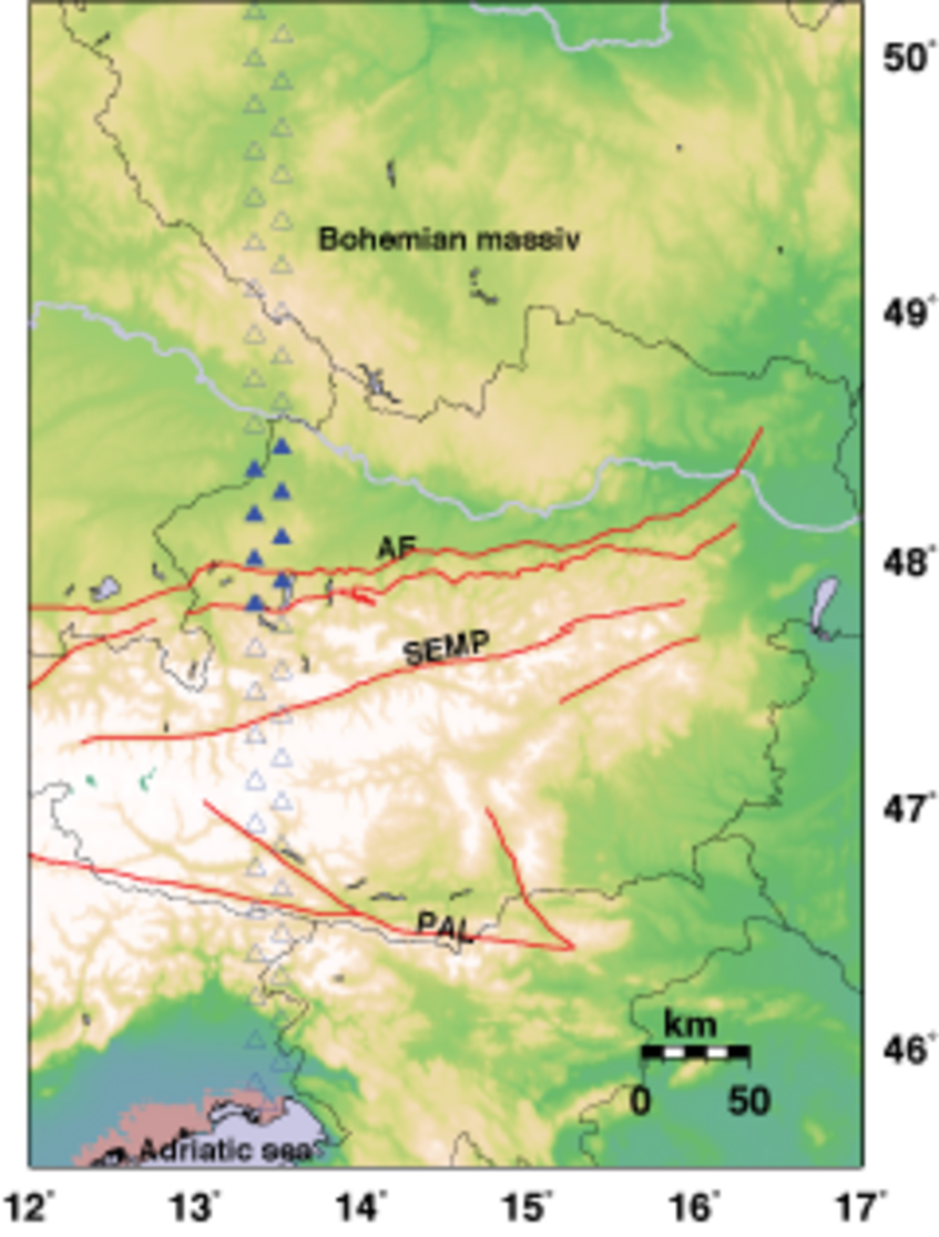
The project focuses on deploying 8 seismic stations along longitude 13.5°E from the German border to the foothills of the Alps, in order to collect seismic records in the time frame of one year. The deployment proposed by the project on hand is designed in the frame of a 550 km long deployment North-South oriented linking the Adriatic Sea to the internal Bohemian Massif. The 8 stations are part of a pool of 55 seismic stations gathered together with ETH Zürich and IG-CAS Prague.
The geometry of station location has been studied in order to maximize the deep coverage along line. A zigzag station location with 10 km spacing (on N-S direction) and 15 km spacing (oblique) lead a uniform ray coverage at depth considering that the majority of the seismic events are coming from North and East directions (e.g. Japan, and Pacific Ocean) and few are arriving from South and West directions (Africa and Atlantic Ocean).
Figure: Map of the planned seismic station location. Filled triangles for the stations to be deployed in the frame this project, empty triangles for stations to be deployed contemporaneously by ETH and IG-CAS.
